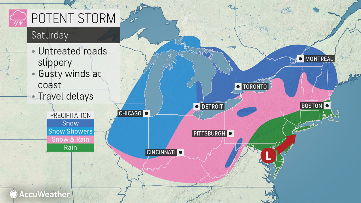
Weekend's Looking Warmer But Will Bring Mix of Snow & Rain| 02:34PM / Thursday, January 23, 2020 | |
After a few days in the icebox, temperatures will be turning above freezing going into the weekend and there's a chance of snow — or more likely rain, as a storm system moves north of the Berkshires.
But with temperatures hovering near freezing, especially in the evening, that rain could turn to black ice making for treacherous driving.
"Because of the patchy nature of the ice, some motorists and pedestrians may think the entire stretch of roads or sidewalks are just wet. The ground can be icy even though car or home thermometers show temperatures above freezing," says Alex Sosnowski, AccuWeather senior meteorologist.
The Northern Berkshires could get a couple inches of snow late Saturday although the forecast so far is trending toward rain or sleet. Parts of Southern Vermont, on the other hand, could be just enough in the zone to get up to 6 inches, especially in the higher elevations. Rain and sleet are expected to continue into Sunday.
The forecast has changed a few times over the last several days and could again by the time Saturday rolls around.
The good news is that some warmer air will be following in the wake of the storm system bringing temperatures up into the 30s during the day.
It could be worse; Newfoundland's still digging out from last week's storm.
| 
 MEMBER SIGN IN