Residents of Hawthorne Street ask questions about the plans.
LENOX, Mass. — The Berkshire Regional Planning Commission is studying pedestrian and bicycle access opportunities around popular cultural institutions in town.
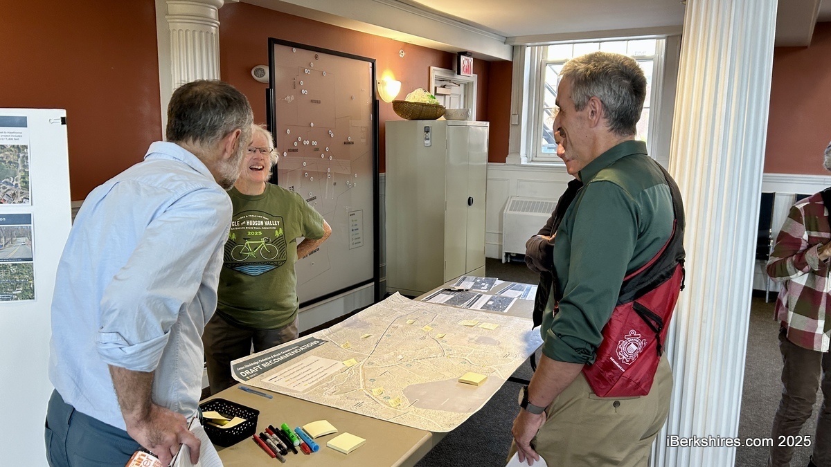
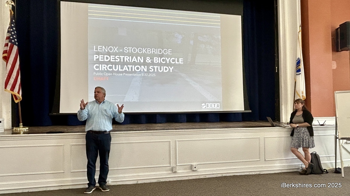
BRPC and members of Beta Group Inc. presented draft recommendations last week from the Lenox-Stockbridge Pedestrian and Bicycle Circulation Study, which would create a multimodal system around West Street, Interlaken Road, Hawthorne Road and Street, and Old Stockbridge Road.
This includes sidewalks, stone-dust paths, crosswalks, and a shared-use path across about six miles in total. BRPC has been working with stakeholders and the technical consultant on this effort since April, and the final report is expected to be finalized within a couple of weeks.
Project Manager Jeff Maxtutis of Beta Group presented a visual of current walking and biking conditions to a group at Lenox Town Hall.
"There's not a lot," he said, displaying a map that shows one existing sidewalk running down West Street and a small portion of Old Stockbridge Road to Hawthorne Street.
"... And aside from that, you're either walking in the road or on the side of the road, in the grass, or biking in the street, so that's part of the issue that we're having. That some people can do that, some people are fine biking in the road, but it's not for everyone."
Recommendations aim to improve connections and address existing gaps for pedestrian and bike access. The design will also make transportation safer and, hopefully, more fun for people not driving while recognizing the area as a "cultural hub."
Maxtutis emphasized that this is a preliminary feasibility study based on available information, site visits, and discussions with the towns, and does not include details such as land surveys, drainage and utilities, and grading.
"It's just based on 'Is it feasible?' and most cases it is feasible, but there's flexibility in the details, which is not part of our feasibility study," he said.
In a press release for the event, BRPC wrote, "No decisions have been made or will be made regarding any projects at this time; this study works to illustrate potential projects and their costs for future consideration by the respective towns."
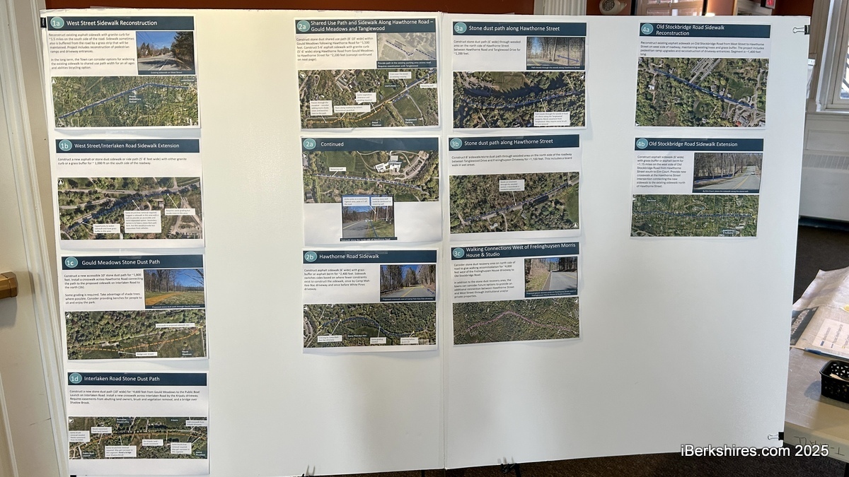
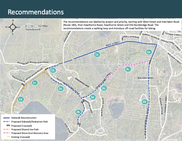
Transportation Planner Anna Sangree presented more than 10 recommendations for the area near Tanglewood:
Reconstructing West Street's sidewalk and extending the sidewalk on Interlaken Road from West Street to Hawthorne Road
A stone-dust path in Gould Meadows
A shared-use path and sidewalk along Hawthorne Road
A stone-dust path on Hawthorne Street
Walking Connections west of Frelinghuysen Morris House and Studio
Reconstructing Old Stockbridge Road's sidewalk and extending it from Hawthorne Street south to Elm Court
Sangree noted that there are nice paths in Gould Meadows, but they are not accessible. A 10-foot, stone-dust path is proposed for about 1,800 feet along the property.
"And there's no opportunity to bike, really, along this stretch of roadway," she added.
"So the idea is to kind of create an accessible path where people can walk, people can roll, and people can also bike on it."
Maxtutis said they want to be sensitive to the environmental area, and the stone dust path has less impact. This material is the byproduct of crushed stone and is used for patios, driveways, and walkways.
A Hawthorne Street resident was concerned about losing character to the area and privacy from the road.
"I've looked at plenty of plans, including these, and I recognize that the details are what really matter, and often when the details start to be implemented, people are surprised," she said.
"…So my concern is with how this plays out? And I would favor looking at both calming, narrowing roads to slow that traffic down, and lighter surfaces, less gray infrastructure, addressing the heat island effect. These are the priorities I would value as a resident, as opposed to who looks to me like, ultimately adding more gray infrastructure, asphalt."
Sangree explained that the natural beauty of the area is a priority, and the facilities aim to increase people's experience outdoors.
"We want to make sure that we're within the character, and we're not changing the character of the neighborhood, but we're allowing people to enjoy these beautiful resources," she said.
Because this is a feasibility study, the planners haven't set a cost for the whole of the improvements or a timeline. Recommendations will be presented in phases, recognizing that the whole project wouldn't be done at once.
pittsfield.com welcomes critical, respectful dialogue. Name-calling, personal attacks, libel, slander or foul language is not allowed. All comments are reviewed before posting and will be deleted or edited as necessary.
Comments are closed for this blog. If you would like to contribute information on this blog, e-mail us at info@iBerkshires.com